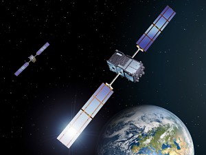
The European global navigation system Galileo, that in the past has been plagued with delays, has moved two small steps closer to it’s initial goal. The European Space Agency (ESA) this Friday launched the first two, of four operational satellites, designed to validate the Galileo concept in both space and on Earth. The launch was made from Kourou, French Guiana, with a Russian Soyuz rocket, that deployed the first two satellites at an altitude of nearly 23 000 km. The fully deployed Galileo system will consist of 30 satellites (27 operational + 3 active spares), positioned in three circular Medium Earth Orbit (MEO) planes at 23 222 km altitude above the Earth, and at an inclination of the orbital planes of 56 degrees to the equator.
The initial plans for the Galileo system was to be up and operational by 2014, but several delays and increased budget costs have now moved the end date well beyond that. The first Galileo satellite was planned to be launched at the end of December 2005, followed by a second in 2006. Now 6 years later these first two satellites are finally been delivered in orbit, and two more will follow in 2012 if everything now goes to plan. The European Commission is now looking to complete the 30-satellite constellation by the year 2019, with two new satellites scheduled to launch during every quarter.
Galileo will be Europe’s own global navigation satellite system, and also the first complete civil positioning system. It will be inter-operable with GPS and GLONASS, the two other global satellite navigation systems currently operational, and deliver real-time positioning accuracy down to the metre range, which is unprecedented for a publicly available system. Offering dual frequencies as standard, Galileo will guarantee availability of the service under all but the most extreme circumstances, and will also inform users within seconds of any satellite failure. With these fail-safe measures in place, and with high positioning accuracy, Galileo will be suitable for safety-critical applications such as guiding cars, running trains and landing aircraft.
As far back as the early 1990s, the European Union saw the need for Europe to have its own global satellite navigation system. The European Commission and European Space Agency have joined forces to build Galileo, which will be guaranteed to operate at all times, except in the direst emergency. Satellite navigation users in Europe today have to determine their positions using US GPS or Russian GLONASS satellites. The military operators of both these systems give no guarantee to maintain an uninterrupted service, and can at any time, limit the system or simply turn it off, in case of a political disarrangement or conflict. By placing satellites in orbits at a greater inclination to the equatorial plane than GPS, Galileo will achieve better coverage at high latitudes. This will make it particularly suitable for operation over northern Europe, an area that is not well covered by GPS systems today.
When development, construction, and operation are all factored in the total bill for European taxpayers is currently estimated to amount to €20 billion, but will also in the end give the European region a more stable system, under civil control. In the current financial climate, where some countries in Europe have been hit hard by recession, the high cost for the Galileo system might difficult for the European taxpayers to accept. At the same time with this new system Europe will be able to exploit the opportunities provided by satellite navigation to the full extent. Manufacturers of positioning receivers and equipment, and also application providers and service operators, will create new business and job opportunities.
